Sicilian Maps & Symbols
Sicilian Maps & Symbols |
|
| This map of Sicily gives the approximate locations of the ancient cities and the distribution of the various populations as of about 450 B.C. The map accompanies an article about King Ducetius, by Jona Lendering. |
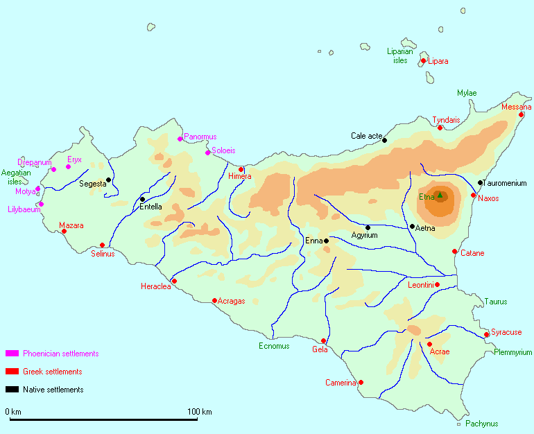 |
| A notice on the web site explains that you may copy and distribute the map for educational purposes but you may not sell it or use it for commercial purposes. |
| Return to... Maps & Symbols |